
The transformation of the village of Eastminster
The maps show the transformation of the village of Eastminster over a ten-year period. Summarise the information by selecting and reporting the main features, and make comparisons where relevant.
The two maps illustrate how the village of Eastminster during a period of ten years.
Regarding the North side of the road, there used to be a woodland in 1999, yet it was replaced by an adventure park in 2009. Otherwise, the residential area had been narrow previously, however, it was lengthened after 10 years, resulting in the park being shortened. Opposite the housing area located a big house with a garden but similarly, it was destroyed to make ways for a hotel, along with a golf course. Besides, the school was relocated to the position in front of the adventure park.
In terms of the remaining side, streets of houses were demolished to be replaced by flat blocks, whereas houses were built on the original site of the public garden. In contrast, a shopping plaza was also constructed where school had been situated, and there appeared the existence of factories and warehouses along the railway station. The hospital solely experienced a slight change which was to be widened. There were shops and railway stations remaining unchanged.
Overall, the village witnessed numerous changes in the facilities, but the most striking one is the appearance of the factories and warehouses and the shopping complex.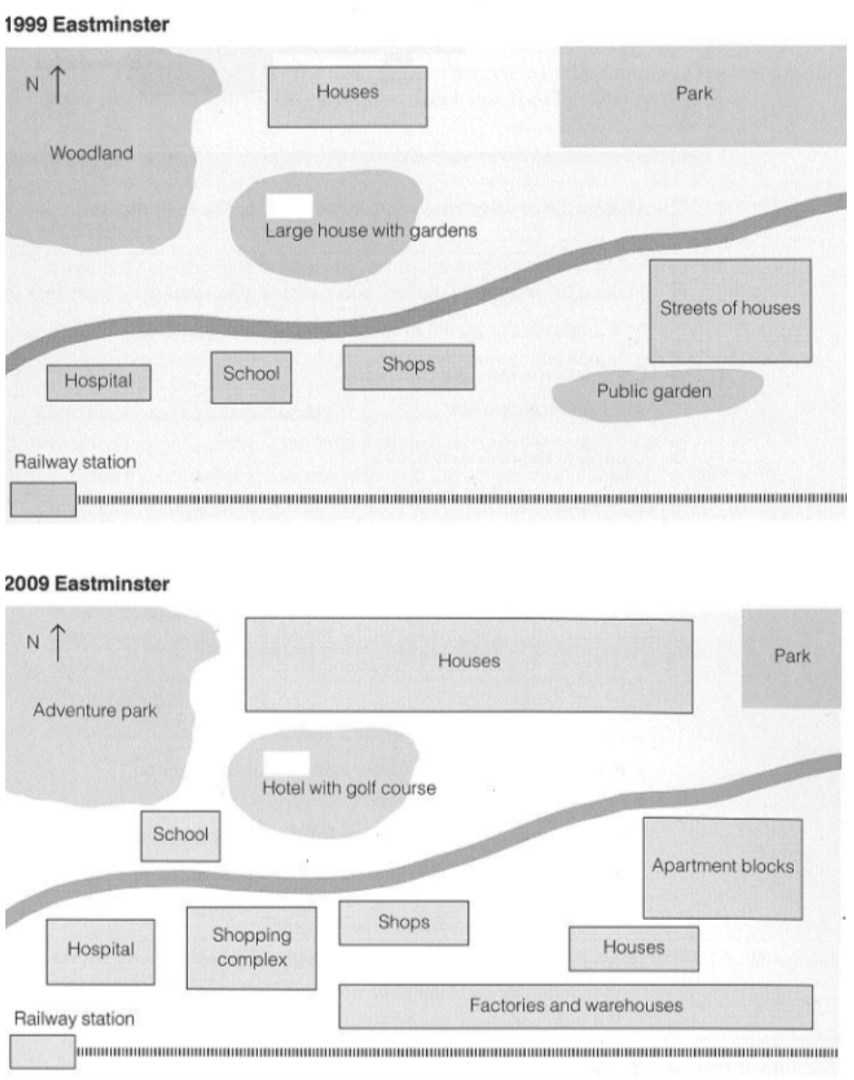
Top answer
You have misplaced the "overall" paragraph. Put it second, after the introduction.
- You have misplaced the "overall" paragraph.
- Put it second, after the introduction.
Get the Weekly English Kit 📬
New words, one handy idiom, and a 2-minute quiz — delivered to your inbox to keep your streak alive.
You have misplaced the "overall" paragraph. Put it second, after the introduction.
 Related Questions