
Please, review my essay
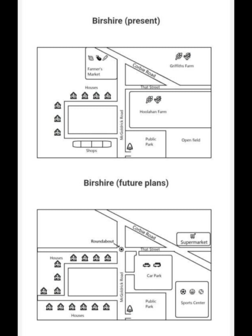
The maps depict Birshire as it is now and how it will look after development.
Overall, the rural town will be transformed into a more residential one with improved transport infrastructure.
At present, McGoldrick Road, a main road running north-south, divides the town into a western and Eastern section. On the western section is a side road lined with houses and shops and a farmer's market. Moreover, the eastern section is separated into a northeastern and southeastern section by That Street. The northeastern section has Corbie Road and Griffiths Farm, while the southeastern one has Hoolahan Farm, a public park, and open field.
In the future, on the western section, the farmer's market as well as the shops will be demolished, the side road will be extended eastward, and more houses will be built along it. After That Street is extended across the western section, a roundabout will be added to the main road. In the eastern part, Corbie Road will be lengthened, and a supermarket will be constructed along That Street. Although the public park will remain unchanged, Hoolahan Farm will be destroyed to provide space for a car park and a sports center, which will mainly occupy the site of the open field.
Get the Weekly English Kit 📬
New words, one handy idiom, and a 2-minute quiz — delivered to your inbox to keep your streak alive.
 Related Questions