
Please I need your feedback
The map below shows the changes that have taken place at the waterfront area of a town called Darwin between 2009 and 2014.
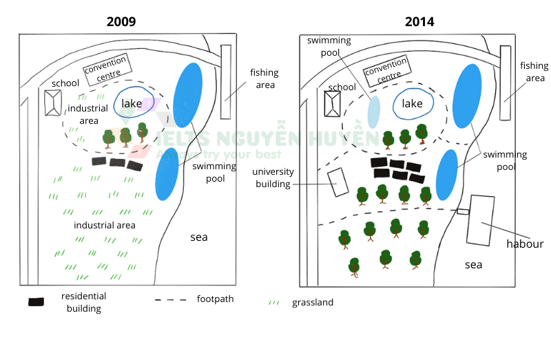
The two maps provide aerial views of the waterfront area named Darwin between 2009 and 2014. Overall, the waterfront has undergone some significant transformations, which include the disappearance of the industrial area and the establishment of new facilities.
Before the changes, the area had three residential buildings, which were, to the north, adjacent the footpath encircling the lake and a few trees, and to the south, next to the grassland. Locating in the northwest were the school and the convention center, fronting the circle footpath. Furthermore, there were two swimming pools located in the northeast and southeast. Finally, the fishing area was located in the northeast corner.
After the development, there are some elements that are still unchanged such as the school, convention center, the lake, and the fishing area. The grassland vanished, making room for several trees planted. There were three more residential buildings added, and not far from the west of these houses, there was a new college building. There were footpaths leading tourists from the outside and the sea to the circle footpath. Inside the circle, a new swimming pool was erected. A harbor was built in the southeast, with a footpath leading to it from the outside.
Top answer
htm
- htm
Get the Weekly English Kit 📬
New words, one handy idiom, and a 2-minute quiz — delivered to your inbox to keep your streak alive.
 Related Questions