
Please Help Review My Task 1
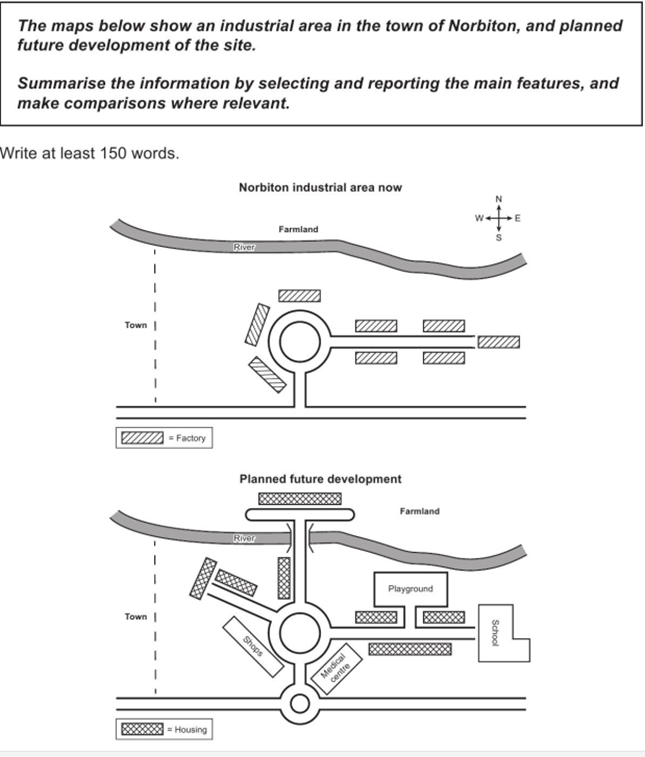
The maps illustrate an industrialized part of the town of Norbiton and forecast its future growth. Overall, the area is expected to transform into a more versatile and populated place, offering facilities and social services.
It is manifest that the present area is mainly focused on industrialization, with eight factories in the locality. At the center of the area, there are three factories surrounding a roundabout, while the others are placed along the road leading from that roundabout. To the north, there lies farmland, which can overlook a long river.
Turning to the second map, the area is projected to offer housing and other social services to inhabitants. The farmland will be moved northeast to construct new houses. Also, there will be a bridge crossing the river and leading straight to the central roundabout. Additionally, the three factories, currently located around the roundabout, will be supplanted by accommodation and shops, while the others will be destructed to pave the way for a school and houses. Along with these changes will come the development of other services, reflected in the appearance of a medical center and a playground in the proximity of residential areas.
Thanks a lot for your help.
Get the Weekly English Kit 📬
New words, one handy idiom, and a 2-minute quiz — delivered to your inbox to keep your streak alive.
 Related Questions