
Please help me to check my IELTS Writing Task 1: Maps
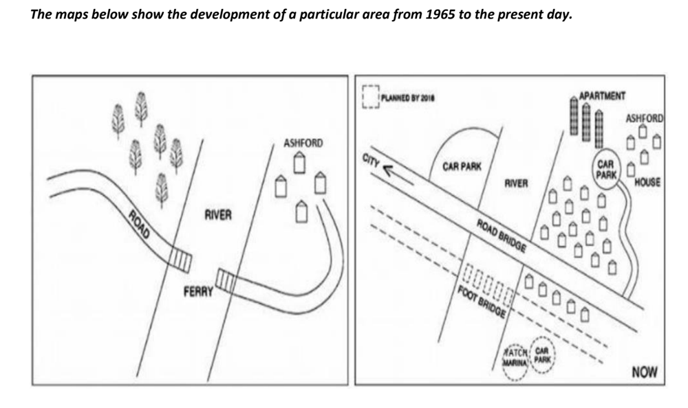
The given maps depict an area before and after some developments from 2005 to now.
The most notable change in the area is the construction of the road bridge, which replaces the ferry. In addition, various infrastructure was built such as a car park, some apartment and houses.
In 1965, there was only the Ashford and the trees on the north side of the ferry, the remainder was an empty land. The ferry now has been replaced by the road bridge which leads straight toward the city. All the trees were chopped down to make room for a big car park on the west of the river. The Ashford expanded its size and the number of factories, among the factories were a car park which can be accessed via minor road connected with the road bridge. Three blocks of apartments were built nearby the river bank and closed to the car park.
On the south side of the road bright, there was a vacant area in 1965. In the present, some factories of Ashford have been established along the road. A bridge is expected to construct in 2018 for pedestrians only. There are yacht marina and car park that will be built on the south side of the food bridge and the east of the river in the same year.
Can you please mark my essay too Thank you so much !!
Top answer
Double-posted. htm
- Double-posted.
- htm
Get the Weekly English Kit 📬
New words, one handy idiom, and a 2-minute quiz — delivered to your inbox to keep your streak alive.
 Related Questions