
Please, help me review my essay, and tell me which areas I need to improve at.
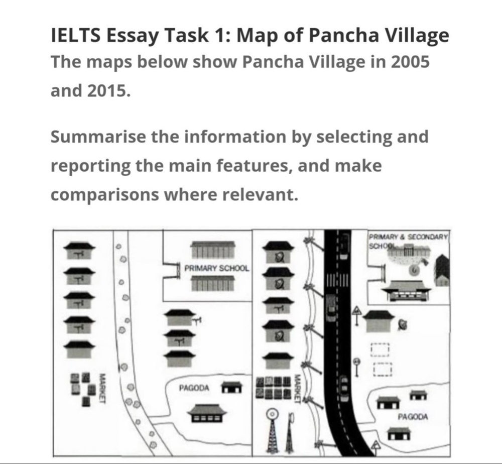
The maps illustrate the village of Pancha in 2005 and 2015.
Overall, the village evolved into a developed town with better road infrastructure and good communication system.
In 2005, at the center of the village was a dirt road running north-south, with a row of houses and markets on its western side. Furthermore, to the east of this road was a fenced primary school, houses, and an area called Pagoda, which contained two houses and was connected to the road.
By 2015, the dirt road had been transformed into a main road lined with telephone poles and road signs, and satellite dishes were added to some houses. In the west of the village, more markets were built, and a communication tower was erected on the southwestern corner. Regarding the eastern section, after the buildings in the primary school were demolished, a primary and secondary school was built. Also, some houses were destroyed, and although a house in Pragoda was knocked down, two more were constructed there afterwards.
Get the Weekly English Kit 📬
New words, one handy idiom, and a 2-minute quiz — delivered to your inbox to keep your streak alive.
 Related Questions