
IELTS Writing Task 1
The maps below show the changes in a rural area town after the construction of a hydroelectric power dam.
You have to change the instructions to describe these maps.
Your essay barely meets the minimum word count. Aim for 170-190 words for Task 1
Answer:
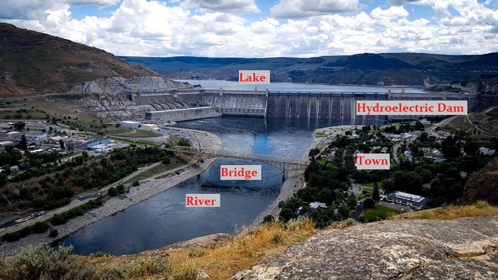
The two maps depict developments in a remote area over the twenty-year period after a hydroelectric power dam was built across a river in 1990. demonstrate (Not a good word choice. Read my advice.) how a town changed over a period of 20 years between 1990 and 2010. 9In the first paragraph, you need to mention some prominent items that will be in the body paragraphs.)
Overall, the town villagers in the area witnessed (Witness is a verb that shows a human action. Time periods, numbers and inanimate objects can not do the action of witnessing. ) a number of dramatic changes, the most noticeable of which are was the formation of a very large lake behind the dam. and the construction of a hydroelectric dam, along with a disappearance of Many features disappeared: the forest, an ancient structure and rare plants and animals.
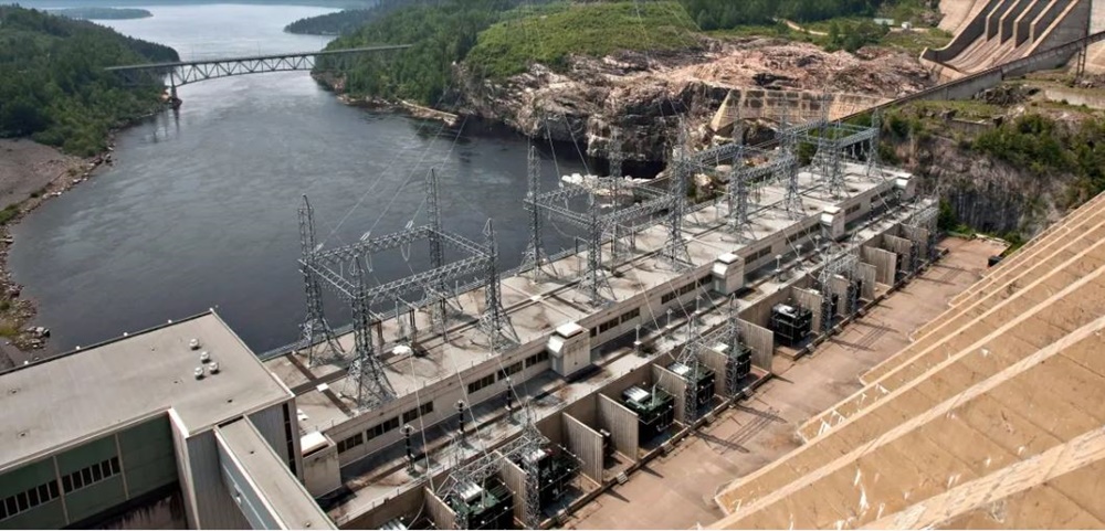
In 1990, there used to be woodland, ancient buildings as well as rare flora and fauna to the west of the river, but they were then substituted (wrong word) by a lake in 2010. (Probably the water covered the area just after 1990, not in the final year.) Moreover, other changes include the establishment of a hydroelectric dam to the south of the lake. (Oh dear, that is very very wrong. When a dam is built across a river, the water stops flowing downstream. It is stopped up, like a plug in a sink. Water collects behind the dam, forming a lake. The dam comes first. The dam actually creates the lake. See the annotated photograph below. The north side of the river goes behind the hills to the left of the dam.)
In addition, the villages were relocated to the south beside the river, while the irrigated farmlands were inundated. removed, (Wrong verb. Land is not "removed" except if there is very heavy earth-moving equipment. It makes much more sense that the farmland was covered up by the lake, and now lies at the bottom of the lake.) making room for the construction of a hotel 20 years later. (You do not have any information when the hotel was built, except it was sometime between 1990 and 2010.) The lake became the central focus of a resort, with a large hotel and a marina for pleasure sailing and fishing. It is also of note that power grids were installed on the left river bank, which facilitates the transmission of electricity in 2010. (The transmission towers and generator plant is just part of the hydroelectric power dam infrastructure. It is not separate by itself. They are all designed and built as part of one construction project. )
There are many other problems with these maps. The scales are completely different, and so it is hard to match the same areas on both these maps. Really, this is a horrible practice exam.
The transmission towers are part of the dam's structure, as you can see in this photo.
Get the Weekly English Kit 📬
New words, one handy idiom, and a 2-minute quiz — delivered to your inbox to keep your streak alive.
 Related Questions