
IELTS TASK 1 - MAP
The two maps compare the coastal area of Melvin Island at two different years, 2000 and 2010. According to the maps, lots of significant changes were established in this nation.
As can be seen from the first map, the coastal region was a green residential zone, with a village covered by woodland and farmland. There were only two places to stay for visitors: a motel to the north and tearooms to the west of the village.
It can be seen from the second map that Melvin Island had transformed into a more modernization. The motel was converted into a hotel complex, while the garages were knocked down and the chalets were built in this place. The tearooms were demolished and replaced by a seafood restaurant. The woodland to the north of the village was developed to a golf course. In addition, several new facilities were constructed. A swimming pool and spa were added to the north of the village, and a marina created. Also, in the south-east of the village, half of the 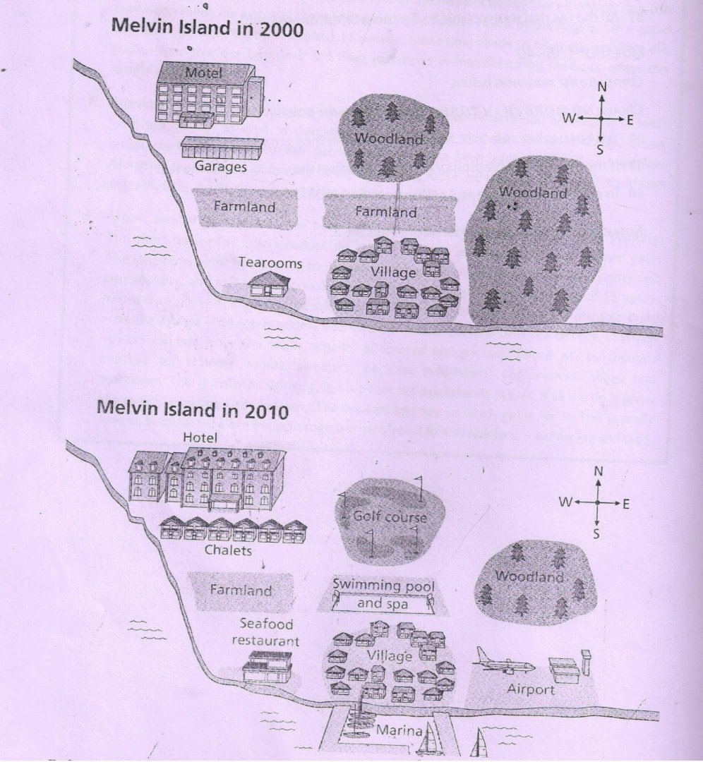
woodland gave way to an airport.
Top answer
What are the instructions? The two maps compare the coastal area of Melvin Island at two different years, 2000 and 2010. According to the maps , (Unnecessary verbiage.
- What are the instructions?
- The two maps compare the coastal area of Melvin Island at two different years, 2000 and 2010.
- According to the maps , (Unnecessary verbiage.
- ) lots of (too casual for an academic essay) significant changes were established (wrong word) in this nation .
- (Did the instructions tell you this is a country?
Get the Weekly English Kit 📬
New words, one handy idiom, and a 2-minute quiz — delivered to your inbox to keep your streak alive.
What are the instructions?
The two maps compare the coastal area of Melvin Island at two different years, 2000 and 2010. According to the maps, (Unnecessary verbiage. This does not describe the diagram.) lots of (too casual for an academic essay) significant changes were estab
 Related Questions